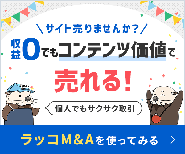
52. The Aborigines


The Tasmanians

by George Weber


Table of Contents


1. Geography amd Environment of Tasmania 

2. Discovery and Discoverers

2.2. The Discovery

2.3. The Discoverers 

3. The Destruction of aboriginal Tasmania

3.1. The British Invasion: convicts, soldiers, settlers 

3.2. The Sealing Community 

3.3 The Black War (1804-1830) and the Black Line (1830) 

3.4. Rounding up the Survivors

- George Augustus Robinson (1791-1866)

- Mannalargenna (ca. 1770-1835) 

3.5. Exile 1: Flinders island and Wybalenna (1832-1847)

3.6. Exile 2: Oyster Cove (1847-1876)

- Truganini (ca. 1812-1876)

- Fanny Cochrane Smith (1834-1905) 

- William Lanne (ca. 1835-1869) 

4. The Tasmanians have survived

4.1. Shrinking Numbers of a dying race

4.2. Not the Last Tasmanians: modern Survivors

The Lia Pootah

The Palawa

4.3. We don't need no Evidence!

4.4. The Use of DNA Evidence 

5. Traditional Tasmanians to 1800

5.1. Traditional Tribes and Groups around 1800

5.2. Religious Beliefs

5.3. Hunting, Gathering, Food and Cooking (including the "Fish- and Bone-Tool mysteries)

5.4. Baskets and tools

5.5. Making and Using Fire

5.6. Song and dance

5.7. Conflict

5.8. Health and Disability

5.9. Death and Burial

5.10. Family Life 

5.11. Decorating, Scarification, Bodypainting

5.12. Huts and Shelter

5.13. Boats 

6. The Tasmanian Languages

6.1. Languages, Dialects and Tribes

6.2. An Orphan or with Family?

6.3. A truly Major Loss

6.4. A New Language or Rising from the Ashes?  

7. Origins, Genetics and outside Relationships 

8. Archaeology and the oldest Tasmanians

8.1. On and off: Tasmania's landbridge to Australia

8.2. Petroglyphs (stone carvings)

8.3. Caves and Midden

8.4. Painted Caves

8.5. The oldest Tasmanians

Tasmanian Video links


1. Geography and Environment of Tasmania


Tasmania is a large island off the southeastern coast of the Australian mainland continent. Politically, the State of Tasmania is a member of the Commonwealth of Australia.

In 2005 Tasmania had a population of 485,000 people and with some surrounding islands covered an area of 332 square kilometres.

Almost 37% of Tasmania is covered by reserves, national parks and World Heritage sites.


 Physical map of modern Tasmania. Black lines are modern roads, black dots modern towns.


The Tasmanian environment (adapted from a Tasmanian government map of 2003 )

Vegetation map


2.2. The Discovery of Tasmania

 Although it is possible that there were earlier western explorers in Tasmania before Able Tasman, it is not very likely. The earlier explorers could make many and profitable discoveries by keeping to warmer and less stormy climate zones where there were also better chances of finding new civilizations and opportunities for riches, trade and conquest. It is odd that Abel Tasman in his voyage should have touched Tasmania, New Zealand and New Guinea - but that he missed the enormously larger Australia!


1.black
1642, Abel Janszoon Tasman, Dutch

2. Red
1772, Nicholas Marion du Fresne, French

3. Light blue
1773, Tobias Furneaux, British

4. blue
1777, James Cook, British

5a and 5b. orange
1792 and 1793, Antoine Raymond Joseph Bruni d'Entrecasteaux, French

6. green
1798, George Bass, British (alone)

7. dark green
1798, Matthew Flinders (British) and George Bass (together)


Main anchorages of the first explorers:

1.black
1642, Abel Janszoon Tasman, Dutch

2. Red
1772, Nicholas Marion du Fresne, French

4. blue
1777, James Cook, British

5. orange
Antoine Raymond Joseph Bruni d'Entrecasteaux, French
5a. 1792, d'Entrecasteaux Channel
5b. 1793, Recherche Bay

7. dark green
1798, Matthew Flinders (British) and George Bass, British

a-c. grey:
1801, Nicholas Baudin, French:
a. Huon River, b. Maria Island, c. Great Oyster Bay

See also map above.


 2.3. Discoverers of Tasmania


1642, Abel Janszoon Tasman, Dutch ( ca. 1603-ca. 1660)

On 24 November 1642 the crew of the two ships Heemskerck and Zeehaen under Admiral Abel Tasman (ca.1603-ca.1660) were the first westerners known to have set eye on a Tasmanian shoreline. The little fleet had set sail from Batavia (now Jakarta), capital of the Dutch East Indies (now Indonesia) and was initially heading west towards Africa before reaching Mauritius. Therre it turned south and later east before approaching Tasmania from the west some 72 days after leaving their home port. Tasman named his discovery Van Diemen's Land after the then governor of Batavia. The island was renamed Tasmania only in 1856 because the old name had become tainted through the penal colony and the atrocities of the "Black War".

Admiral Tasman and his masters in Batavia were above all interested in finding new trading opportunities, trade routes, products and customers. From their point of view the newly-discovered island was a disappointment. Its climate was too cold, wet and windy to grow spices, there was no treasure to be had and the invisible natives did not look promising either as slaves, suppliers or customers.

Tasman and his crew never saw any Tasmanians but they heard "...certain human sounds, and also sounds resembling the music of a trumpet or a small gong not far from them, though they saw no none." The crew also found two large trees with clearly human-made notches in their stems that formed steps to climb up into the crown of the tree, presumably to collect fruit or birds' eggs. They also reported smoke rising from a tree but, again, no humans were found. Tasman's men concluded that "people of extraordinary stature" must be living there. The Dutch planted a pole with the Dutch East India Company mark on it and flying the flag of the Prince of Orange as a sign to both future western visitors and the unseen natives, that the Dutch had taken possession of the land and its inhabitants. As Tasman later reported, the natives still "did not show themselves, though we suspect some of them were at no great distance and closely watching our proceedings."

Tasman reported to the authorities on his return to Batavia that there was no profit or trade to be had there and the Dutch authorities took no further interest in Van Diemen's Land.

For the next 130 years, the Tasmanians were left in peace.


1772, Nicholas Marion du Fresne, French (1724-1772)

Trade opportunities in the still little-known southern Pacific also attracted French interest. Setting out from Mauritius in late 1771 Nicholas Marion du Fresne with two ships, the Mascarin and the Marquis de Castries , sailed east in the direction of for Tasmania and beyond. His aim was to investigate if the route Tasman had taken 130 years before could be developed into a French trade route to China, conveniently bypassing the British- and Dutch-dominated East Indies. The French also wanterd to find out whether it was a practicable route to the Pacific where France (under the influence of Rousseau) was interested especially in Polynesia. The first meeting with Tasmanians also came under the influence of Rousseau: du Fresne was determined to send naked sailors ashore whenever the locals showed themselves naked to the visitors. When anchoring very near the place that Abel Tasman had chosen so long before, du Fresne sent two naked sailors ashore to meet the naked Tasmanian men waving at them. The women and children had earlier been observed hiding in the bushes. The two nudist sailors were presented by one of the older Tasmanian men with a firebrand, which the French took to be a sign for friendship and peace. Duclesmeur, second in command of the expedition, described what followed:

Our men accepted (the firebrand) and gave a mirror to the old man. His astonishment and that of the other savages showed incomprehension as one after the other saw themselves in it. The colour of the two sailors did not surprise them less and after they had examined them closely they put down their spears and danced before them. This reception was such as to give confidence and Mr. Marion determined on landing. The spot where we disembarked was dominated by a large rock of which the natives were in possession. However, several of them came down and presented us with a fire which we accepted, giving them in our turn some scraps of cloth and some knives...Of a truth our small numbers had not up till then caused any uneasiness, but they seemed greatly alarmed at the arrival of a third boat and made all sorts of menacing demonstrations to prevent a landing. Mr. Marion, not wishing to excite them, ordered the longboat to stop rowing, but its impetus brought it close to the shore. The savages rained on us a shower of spears and stones, one of which wounded M. Marion on the shoulder and another struck me on the leg. We discharged several shots at them and at once they took to flight, uttering frightened cries.

Several Tasmanians were wounded and at least one killed in the fray. On return to France, Rousseau was told about the incident and exclaimed "is is possible that the good Children of Nature can really be so wicked?"


1773, Tobias Furneaux, British (1735-1781)

Captain Tobias Furneaux was an English navigator and Royal Navy officer who accompanied James Cook on his second voyage of exploration. Has was the first man to circumnavigate the earth in both directions.

Furneaux served in the Royal Navy on the French and African coasts and in the West Indies during the later stages of the Seven Years' War (1760&endash;1763). He was second lieutenant under Captain Samuel Wallis on a voyage around the world (1766 -1768).

In 1771 he was promoted to commander and put in charge of the Adventure which accompanied James Cook (in the Resolution) on his second voyage.On this expedition Furneaux was twice separated from his leader: during the first separation he explored major parts of the southern and eastern Tasmanian coasts and made the earliest British chart of the area. Most of the names he gave to geographical features in the area now standard. Cook, visiting the area on his third voyage 1777, confirmed Furneaux's findings, maps and names with minor changes, and also named the Furneaux Group of islands after him.


1777, James Cook, British (1728-1779)

Only four years after the unhappy French visit to Tasmania, the locals experienced their third known visit from the outside world. The famous British explorer, Captain James Cook with the ships Resolution and Discovery anchored at Adventure Bay connecting North and South Bruni Island on 26 January 1777. He stayed four days.

Cook was on his third voyage around the world, this time from Great Britain via South Africa to the Pacific. It was to be his last as Cook would be killed two years later at Hawaii.

Cook had heard of Marion du Fresne's dramatic experiences with the Tasmanians but (although his first and second voyages had brought him to western Australia and New Zealand) he had not yet visited Tasmania. Cook had a great deal of experience with "primitives", both of the "soft" (e.g. Tahitian) and the "hard" (e.g. western Australian) varieties. He liked the idea of "hard primitives", viewing them

...as a renunciation of the luxuries and excesses of civilization in which the virtues of endurance ancd courage were called into continuous operation by the vicissitudes of daily life" (Smith B. 1960. European Vision and the South Pacific 1768-1850. London: Oxford University Press, p. 126)

On the third day of Cook's stay, the first Tasmanians were spotted when around ten of them walked along a beach. Cook was on his anchored ship when he received the news and hastened ashore to greet them. He had read Du Fresne with profit, for he used only a longboat with no more than five men in it, commanding the others to stay out of sight. After Cook had landed, several of the Tasmanian men came out of the bush and seemed quite unafraid. They also showed no interest in the gifts of beads that Cook offered. Instead, they seemed fascinated by his striped coat. One man held a spear but dropped it when one of the crew gave a friendly sign, coming down from the edge of the wood to the beach with three others, followed soon after by the rest of the group. No violent incidents occurred.

All Tasmanians went naked and wore no ornaments, but they did have what appeared to be ornamental scars, large ridges raised on the skin. As Cook noted:

(They are) of the common stature but rather slender; their skin was black and also their hair, which was as woolly as any native of Guinea, but they were not distinguished by remarkable thick lips nor flat noses, on the contrary, their features were far from disagreeable; they had pretty good eyes and their teeth were tolerable even but very dirty; most of them had their hair and beards anointed with red oinment and some had their faces painted with the same composition.

Even though Cook admired "hard primitives", he did not think the Tasmanians had "sufficient civilization" to justify their continued occupation of their island. Instead he felt that the land was "practically unoccupied" since there was no evidence of religion or cultivation of the soil or of a settled law. In his view this made the land "unoccupied" and he did not think the Tasmanians would oppose European settlement. Cook's view remained accepted wisdom in regard to the Tasmanians among the British - until the British found out how mistaken they were when they tried to occupy and settle the island after 1803. 

Below:
Captain Cook's meeting with Tasmanians on 29 January 1777 (by an unknown artist on Cook's crew).


1792, Antoine Raymond Joseph Bruni d'Entrecasteaux, French (1739-1793) 

D'Entrecasteaux was charged by the French Assembly to search for the missing La Pérouse who had last been heard of in 1788 when departing from Botany Bay in Australia. He was promoted to Rear Admiral and given two ships, La Recherche and L'Espérance.

The expedition departed from France in September 1791 and headed via South Africa to Van Diemen's Land. On 20 April 1792 Tasmania was sighted and three days later the two ships anchored in a harbour which is now named after him the Entrecasteaux Channel. The little fleet stayed there for five weeks until 28 May 1792.

D'Entrecasteaux, on first seeing the Tasmanian forest wrote:

...trees of an immense height and proportionate diameter, their branchless trunks covered with evergreen foliage, some looking as old as the world... closely interlacing in an almost impenetrable forest, they served to support others which, crumbling with age, fertilised the soil with their debris... nature in all her vigour, and yet in a state of decay, seems to offer to the imagination something more picturesque and more imposing than the sight of this same nature bedecked by the hand of civilised man... Wishing only to preserve her beauties we destroy her charm, we rob her of that power which is hers alone, the secret of preserving in eternal age eternal youth.

Painstaking cartographic work was carried out for which the hydrographical engineer and cartographer C.F Beautemps-Beaupré was responsible. He is now regarded as the father of modern French hydrography and his work was superior to anything that had been done before in this field. His charts were published in an Atlas du Voyage de Bruny-D'Entrecasteaux in 1807. In fact, the charts we so detailed and accurate that the British subsequently used them for their own naval charts. Among Beautemps-Beaupré's important discoveries was the d'Entrecasteaux Channel between the Tasmanian mainland and Bruny island.

No Tasmanian aborigines were seen during this first visit although traces of a human presence were noted.

The French fleet left Tasmanian waters on 28 May 1792 and, continuing the search for La Perouse, headed for the Pacific and Australia.

Eight months later, desperate for fresh water, the fleet returned to Tasmania and anchored on 20 January 1793 in Recherche Bay for a 5-week stay.

It was during this second visit that some contact was established with Tasmanian people. D'Entrecasteaux noted that if he had stayed a little longer, he would have had the opportunity "to acquire interesting insights into the lifestyle of human beings so close to nature, whose candour and kindness he felt contrasted so much with the vices of civilization." However, the expedition's main task and interests lay not with the native Tasmanians but with cartography. The opportunity was passed up when the little fleet left Tasmania on 21 July 1793 with d'Entrecasteaux making a final comment

(The Tasmanians) ...are interesting men in every respect, with whom I would have liked to have spent all the time we have been forced to remain at this anchorage.

Despite the apparently limited contact, d'Entrecasteaux noted that the possibility of polygamy in Tasmania had lead to some debate among the expedition members, but that ultimately the question could not be resolved. It was also noted that the language of the Tasmanians of Bruny Island was the same as that of the Tasmanians living on the mainland.

D'Entrecasteaux's account is also significant because it supports the archaeological evidence that Tasmanian Aborigines did not eat fish (see The Ancient Tasmanians).


1798, George Bass, British (1771-1803)

George Bass was born in Lincolnshire, England. He trained as a surgeon and went to Australia in 1795. He explored much of the coast of Southeastern Australia between Sydney and what is now Melbourne and was among the first to suspect that Tasmania was an island not connected to Australia. His suspicions were roused when he observed the rapid tide and long south-western swell of the sea immediately south of Australia. He proved the island status of Tasmania in 1797 when he and his friend Matthew Flinders (see below) together sailed right around Tasmania in the Norfolk . The Strait between Tasmania and Australia was named Bass Strait in his honour. In 1803 Bass was lost at sea.

Bass is not known to have had any contact with Tasmanian aborigines.


1798, Matthew Flinders, British (1774-1814)

Matthew Flinders was born in Lincolnshire, England. Both grandfather and father were medical doctors who expected Matthew to follow in their footsteps. He did not, preferring instead to read Robinson Crusoe . He also volunteered early for naval service and was accepted by Captain Thomas Pasley of the Scipio. In 1791 Flinders set sail on the Providence for Tahiti with Capt. Bligh (of Bounty fame) in what was to be one of the most successful exploratory journeys of his time. The Providence also passed he South-east coast of Tasmania and charted many islands there for the first time. Capt. Bligh entrusted the young man with charting, astronomical observations and the care of the precious and important ship's time keepers.

Bligh and his crew were feted as heroes when they returned to England in 1793. Flinders then joined Rear Admiral Sir Thomas Pasley on the Bellerophon. The French revolutionary wars were raging and Flinders joined in time to take part in running battles with the French navy and was soon promoted aids to the Admiral.

When peace was made with the French, Flinders sailed aboard the Reliance to Australia. On board that ship and on his way to take up his appointment was the colony's second Governor, John Hunter. Also on board was a childhood friend and now a medical doctor and ship's surgeon, George Bass. Together, the two took every opportunity for exploring and charting. Back at Deptford, Bass had begun to plan and equip himself for the venture. He had bought a tiny six-foot (1.82 m) boat named Tom Thumb which was shipped from from England inside the Reliance's cutter.

In this tiny boat, Bass and Flinders with an assistant charted the difficult coastal inlets and rivers around Syndey harbour. The new Governor Hunter then provided the two young explorers with a larger vessel, the Norfolk and instructed them to sail south to investigate the long-held suspicion that Van Diemen's land (Tasmania) was not part of mainland Australia. A few months later, in 1798, Bass and Flinders returned triumphantly to proclaim Tasmania indeed an island, separated by a strait which was then named in honour of Bass. It was an important discovery that cut several days travel from the long voyage from England. The two young men also acquired a deserved reputation as fearless explorers.

Between 1795 and 1798 Bass mapped much of the southeast coast of Australia. Bass and and Flinders together next sailed completely around the island of Tasmania which allowed Flinders to chart the Tasmanian coastline in detail. Bass planned a Natural History and attempted a study of the Tasmanian aborigines but he failed to do so. He only ever met one nameless Tasmanian man in a brief but peaceful encounter. I took Baudin's expedition some four years later to make a first comprehensive study of the Tasmanians.

On his way back to England, in 1803, Flinders had to stop for repairs at the Île de France (now Mauritius). Suspecing him of being a British spy, the French imprisoned Flinders for more than 6 years and confiscated his very valuable charts and papers. He was freed only when the British took over the island and he could return to England in 1810. But there he found himself a ruined, sick and largely forgotten man. He wrote an account of his travels ("Voyage to Terra Australis Undertaken for the Purpose of Completing the Discovery of that Vast Country") and died the day after it was published.    


[ Go to HOME ]


Click on icon for Tasmanian video clips


 Last change 29 March 2008